Office and Field software for Surveying, Construction Layout and Engineering
Carlson Survey Supply provides software for all of your Land Surveying, Civil Engineering and Construction layout needs.

Carlson iCAD
Carlson iCAD is a .DWG file based affordable CAD program with perpetual license. Perfect for drafters to create or finish drawings and for engineers to review drawings. Compatible with drawing files from most popular CAD programs.

Carlson Survey
Carlson Survey is a Windows software application created specifically for Land Surveyors. Together with SurvCE/PC you can easily manage the complete job cycle from Field to Finish. With minimum effort and time, Carlson Survey allows users to design and produce a 2D drawing, as well as create enhanced 3D surface models and construction layout data sets.
You can Renew your Maintenance here.

Carlson SurvNET
Unlike other Network Least Squares programs, Carlson SurvNET automatically means all horizontal and vertical angles and slope distances. No need to manually mean and input all multiple direct or reverse, or closed horizon pairs, of angles and distances; SurvNET does this automatically. SurvNET is included with Carlson Survey. Carlson Survey software is provided as a perpetual license with no requirement to update every year.
You can Renew your Maintenance here.

Carlson Civil & Civil Suite
Unlike other Civil programs Carlson Civil, and Civil Suite, is focused on customer needs. As a result it provides the most robust automation and ease-of-use of any civil design solution available today. Experience real productivity with dynamic updating without a single custom object. Carlson software is provided as a perpetual license with no requirement to update every year.
You can Renew your Maintenance here.

Carlson Hydrology
Carlson Hydrology is a comprehensive, yet easy-to-master civil engineering software solution providing automation you can use to meet your hydrology needs. Full 3D road and lot design feed directly into flow calculations and drainage design. Carlson Hydrology software is provided as a perpetual license with no requirement to update every year.
You can Renew your Maintenance here.

Carlson GIS
With tools for data capture and linking, data labeling, import/export of SHP files, polygon topology creation and analysis, and more, Carlson GIS is an awesome GIS “Swiss Army Knife” for the Surveyor or Engineer. The GIS editor supports the import and export of the Esri® Geodatabase and provides a smoother workflow with Esri ArcGIS® services.
You can Renew your Maintenance here.
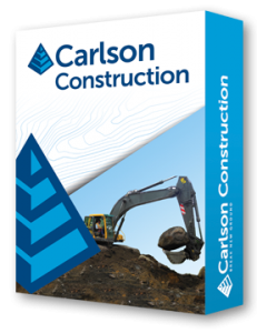
Carlson Construction
Carlson Construction is an integrated cut/fill takeoff and 3D surface modeling software solution designed for site and road construction. It offers powerful inspection and 3D viewing tools for elevating 2D designs to 3D model files. Carlson Construction software is provided as a perpetual license with no requirement to update every year.
You can Renew your Maintenance here.
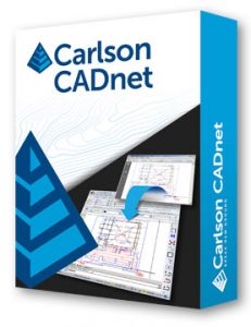
Carlson CADnet
Carlson CADnet allows users to create CAD from non-CAD documents such as PDFs, raster images, and paper plans. CAD text can also be generated from raster images with CADnet’s built-in Optical Character Recognition (OCR). CADnet gives users the ability to import BIM models (doors, windows, walls, roofs, etc.) and bring them into CAD as CAD entities; plus, CADnet includes a routine to export surfaces into BIM.
You can Renew your Maintenance here.

Carlson SurveyGNSS
Carlson SurveyGNSS post-processing software is a reliable and precise tool for all post-processing applications and is tightly integrated into the Carlson field and office workflow.
You can Renew your Maintenance here.

Carlson P3D Topon
Bridge the gap between drones and CAD with Carlson Precision 3D Topo. Import Survey data, points, polylines, surfaces, point clouds, traditional LIDAR & aerial drone survey data, and more from a wide variety of programs and entities to create usable 3D surfaces. Designed for use by Surveyors, Civil Engineers, and Contractors.
You can Renew your Maintenance here.

Carlson Point Cloud
Carlson Point Cloud is a modular program that provides this powerful ability to go from field scan to finished plat, all with seamless integration to Carlson Survey, Carlson Civil and Carlson Mining. Carlson Point Cloud delivers a whole new level of powerful automation for large data sets. It gives laser scanner users the ability to process millions of data points with Carlson Software ease-of-use.
You can Renew your Maintenance here.
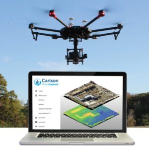
Carlson Photo Capture
Make your Drone into a Survey Crew with Carlson Photo Capture and Point Cloud software. Stitch your drone images together to make a single 3D image and tie it to your control in Carlson Photo Capture. Export a point cloud and edit it in Carlson Point Cloud.
You can Renew your Maintenance here.

Carlson Takeoff is a cut/fill volumes and data prep (for layout or machine control) program that can estimate jobs using paper plan digitizing, PDFs, or electronic CAD files. Take your project from Estimate to 3D model for layout with Carlson TakeOff.
You can Renew your Maintenance here.

Carlson SurvPC Data Collection software is a powerful feature rich application that works like Surveyors do. Works on Windows 7 & 10 tablets.

Carlson SurvCE Data Collection software is a powerful feature rich application that works like Surveyors do. Works on Windows Mobile devices.